Routes
Explore Our Community By Bike
We love riding our bikes as much as you do! Check out the awesome community rides, events, and cycling clubs that we support. Learn more about the local happenings that interest you, and get involved today!
Greenway Routes
KIWANIS CRUISE | 10.6MI | 484FT ELEVATION
A nice little ride! Shortly after entering the Crabtree Creek trail at Raleigh Blvd, there's an optional ~300yd gravel fire road to the left if you're feeling spicy (it connects back to the pavement). From there, it's easy cruising to Kiwanis Park for a sit and a snack, and then back to the shop via some well-biked neighborhood streets. You'll get to try out the new-ish Wade Ave bike/walk underpass too.
FARMER'S MARKET LOOP | 11MI | 539FT ELEVATION
A long-way-around greenway route through Dix on the Rocky Branch trail, to the Walnut Creek trail on Centennial Campus. Hops over to the Centennial Bikeway Connector towards the State Farmer's market, and then back into town via Walnut Creek and Rocky Branch trails.
NCMA OUT & BACK | 14.4MI | 874FT ELEVATION
Hop onto the Rocky Branch trail downtown and cruise through State's campus. You'll also take the Reedy Creek greenway past Meredith (it's a very collegiate ride) and across the 440 greenway overpass (wave to the cars!) Land at the North Carolina Museum of Art to visit the exhibits or picnic in the museum park.
BIG CIRCLE | 18.6MI | 724FT ELEVATION
A greenway tour counterclockwise around Raleigh. You'll start on Crabtree Creek trail at Raleigh Blvd and eventually end up on House Creek trail, which hits some optional bits of dirt and singletrack marked on the map. You'll end up at the 440 greenway overpass that takes you to the NCMA, but you'll continue straight onto Reedy Creek trail past Meredith, through State's campus, and from there the Rocky Branch trail will take you back to downtown.
CRABNEUSENUT | 20.5MI | 796FT ELEVATION
This route is a short ride that takes you from the shop into the Oakwood and Longview neighborhoods east of downtown, eventually leading to the Crabtree Creek Greenway. This will follow down to Anderson Point Park and the Neuse River Trail, before quickly hopping onto the Walnut Creek Trail and winding back into Chavis Park on the south side of downtown. We like this ride as it’s less than twenty miles, but makes for a relaxing hour or so on the bike. The route ends right near downtown, which makes for the perfect opportunity to stop for a bite to eat or drink at a restaurant, bar, or coffee shop.
BELTLINE LOOP | 36.8MI | 1572FT ELEVATION
Just a really big loop entirely on greenway.
TRASH MOUNTAIN| 48.1MI | 1320FT ELEVATION
An uncomplicated, meditative greenway trek with optional singletrack and GREAT scenic vista at the end.
Road Routes
JUBALA TO JUBALA | 23.2MI | 1393FT ELEVATION
Credit for this route goes to the NC State Cycling Club!
Start at Jubala on Hillsborough Street. Neighborhood streets will take you to the Jubala in North Raleigh, and then back to where you started. Pro tip: do this ride on Free Espresso Friday.
IN A JAM | 21.8MI | 777FT ELEVATION
This is a classic Raleigh road ride for those who find themselves crunched on time. The route takes you from the edge of downtown south down Garner Road, which starts out rather industrial but eventually mellows out to quieter country scenery. This road is traffic by a lot of road riders, so most vehicles should be familiar with seeing bikes on this stretch of road. The route lollipops on Auburn Church before heading back into down, but there are options to extend the route into the more rural areas of Knightdale, Wendell, or Clayton. You can also hop on the Neuse River Trail and take that back into town after wearing out your legs on the road.
COUNTRY ROAD RIDE | 57.5MI | 2037FT ELEVATION
A longer road ride for those who want to make use of their time getting out of town and stretch out their legs. After following Garner Road down through Garner, you'll cut behind Clayton and eventually get out to country roads near Archer's Lodge. You'll eventually going through both Wendell and Knightdale, and eventually will wind up back on Garner Road for the run back into town. This route has some modest hills, but can be rather trying on windy days. Much like other road rides in this area, you can hop on the Neuse River Trail at several points if you'd like a more direct or relaxed way back into town. Try stopping at Ground's Cafe in Wendell Falls, or the Mexican Bakery in downtown Knightdale for a mid-ride espresso or pasty.
TURTLE HOLE RIDE | 71.5MI | 3327FT ELEVATION
A nice long ride that takes you on some well-cycled roads & a few stretches of greenway out to the Eno River (and back to Raleigh). There are a few gas stations along the way for resupply stops, and you'll ride through downtown Durham too. The trailhead that leads to the river is at the end of a residential street, and it's a 10 minute hike down to the water for a swim. You can easily cut the ride in half by taking the train from Durham back to Raleigh when you're all tuckered out.
Gravel Routes
TURKEY CREEK LOOP IN UMSTEAD | 31.1MI | 1628FT ELEVATION
This 30+ mile mixed terrain ride heads west from OCCP through Downtown Raleigh past North Carolina State University and Meredith College to the Rocky Branch Greenway. You ride through the hilly North Carolina Museum of Art, past Schenck Forest and through Umstead State Park. There are two water fountains and a bike repair stand in Umstead and many services along the route in and out of town. Start your ride at Yellow Dog Bread across from the shop and swing by Boulted Bread on South Street on the way back into town before returning to OCCP. You’ll need the fuel. Umstead is hilly and a blast to ride it’s crushed limestone trails. Yield to horses and pedestrians. Check out the route and queue sheet here on Ride with GPS.
MTB Routes & Resources
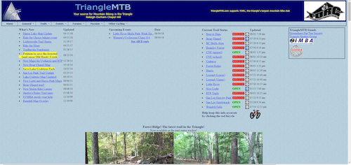
There are a ton of great mountain bike trails in Raleigh and the greater Triangle area. Check out TriangleMTB.com and TORC-NC.org. Triangle MTB will not only provides a listing of trails but also let's you know when the trails are open or closed due to weather conditions. Once you are at the MTB trail, there are signs which will guide you through the trails.
Oak City Cycling Challenges
NEUSE DEUCE 200K | 128.9MI | 3232FT ELEVATION
This 124-mile ride takes you up and down the Neuse River Trail, testing your resolve and mettle as you twist and turn along the winding river. You'll travel from the bike shop to the Crabtree Creek Greenway, eventually hopping onto the Neuse and traveling up north until you reach Falls Lake. From there, you will take the trail all the way to the southern terminus in Clayton, and then head back up north to the North Wake Landfill Park. The ride ends winding back into town along the Walnut Creek Greenway. Please read this blog post about the ride, which more thoroughly details the experience and what your should bring along with you. It's a tough ride, but you can do it!
LUCKY BIKE 100 | MOSTLY PAVED | 100MI | 2037FT ELEVATION
Another challenging but fun ride that takes you from Raleigh, to Durham, back to Raleigh. The ride starts at the shop and cuts through downtown, taking the Rock Branch greenway through North Carolina State University and Meredith University. You'll wind through the North Carolina Museum of Art, where you pick up the Reedy Creek Trail which takes you to Umstead State Park. Here you'll find yourself riding through gravel roads, eventually cutting across the town of Cary through multiple greenways and neighborhoods. There is a brief stretch of road riding before getting to the American Tobacco trail, which is a mix of crushed limestone and paved path. This puts you out right in Downtown Durham, where you can refuel with some food and drink. The route proper requires you to ride back the same way, but you can also take the Amtrak back into downtown Raleigh if you're not feeling it. Again, check out our blog post for more information on this ride.
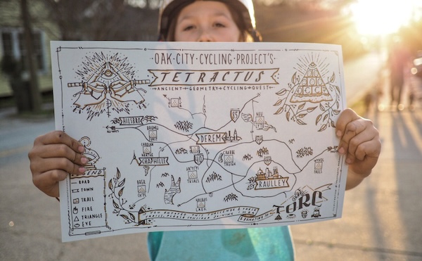
TETRACTUS | 10 POINT MTB CHALLENGE IN THE TRIANGLE
A Tetractus, or Tetractys, or Tetrad is a mystical triangular figure consisting of ten points. Thus, here are ten TORC trails within the Triangle (Mileage of trails are from TORC directly and may not be exact to what MTBproject.com has listed):
- Briar Chapel (12 miles)
- Brumley Nature Preserve (8 miles)
- Carolina North Forest (18 miles)
- Harris Lake (10 miles)
- Lake Crabtree (9 miles)
- Little River (7 miles)
- New Light (10 miles)
- RTP (4.5 miles)
- Solite (0.5 miles)
- Williamson Preserve (12 miles) *Formerly Wendell Falls, which is still on the map, but pretend it shows Williamson.
Read more about the challenge in our blog post.
Get the Gear You Need
Shop for the perfect bike before your next ride. We’re here to answer all of your cycling related questions.